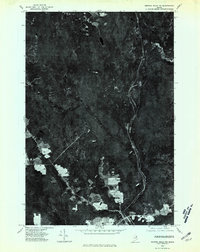
1975 Map of Smyrna Mills NW
USGS Topo · Published 1980About this map
Smyrna Mills and its surrounding timberlands are captured in this mid-1970s orthophotoquad, showing a landscape defined by industrial forestry and scattered rural settlements. The orthophoto format provides a direct visual record of land use, where clear-cut patches and varying stages of forest regrowth contrast sharply with the dense canopy of the northern Maine woods. Small clusters of activity are visible at Shorey and Dudley, while the winding course of Dudley Brook and the elevation of Pervere Ridge reveal the underlying topography. The settlement pattern follows the established road network, with agricultural clearings and residential plots concentrated near the primary thoroughfares, illustrating the transition between managed forest and the community hub of Smyrna Mills.
Find a feature on this map
5 named features on this map. Tap any name to fly to it.
Don’t see what you’re looking for? This feature index may not catch every label — zoom into the map to look around manually.
Map Details
Editions of this 1975 Smyrna Mills NW Map
This is the sole edition of this map. No revisions or reprints were ever made.
Other maps of this area

1935 · Howe Brook
USGS Topo · 1:48,000

1937 · Smyrna Mills
USGS Topo · 1:62,500

1939 · Howe Brook
USGS Topo · 1:62,500

1940 · Island Falls
USGS Topo · 1:62,500

1940 · Oxbow
USGS Topo · 1:62,500

1942 · Island Falls
USGS Topo · 1:62,500

1942 · Oxbow
USGS Topo · 1:62,500

1954 · Howe Brook
USGS Topo · 1:62,500

1954 · Presque Isle
USGS Topo · 1:250,000

1955 · Smyrna Mills
USGS Topo · 1:62,500