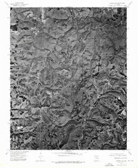
1974 Map of Smyrna NW
USGS Topo · Published 1975About this map
Ben Hur sits atop the high ground in this orthophotoquad, which utilizes 1974 aerial imagery to show the rugged, dissected plateau of northern Pope County. The landscape is defined by deep drainage patterns where the Fork and the Bayou have carved winding paths through the timbered hills. Unlike a traditional topographic map, this photographic record reveals the exact extent of clearing for small farms and homesteads, providing a raw view of the Ozark back country before modern development changed the visual character of the region. The limited development at Ben Hur suggests a quiet, isolated community life centered on the winding ridge roads that navigate the complex network of hollows and ridges.
Find a feature on this map
3 named features on this map. Tap any name to fly to it.
Don’t see what you’re looking for? This feature index may not catch every label — zoom into the map to look around manually.
Map Details
Editions of this 1974 Smyrna NW Map
This is the sole edition of this map. No revisions or reprints were ever made.
Other maps of this area

1879 · Washington
USGS Topo · 1:62,500

1887 · Smyrna
USGS Topo · 1:62,500

1889 · Treat
USGS Topo · 1:62,500

1889 · Marshall #3
USGS Topo · 1:62,500

1892 · Marshall
USGS Topo · 1:125,000

1894 · Marshall
USGS Topo · 1:125,000

1901 · Marshall
USGS Topo · 1:125,000

1932 · Treat
USGS Topo · 1:62,500

1933 · Mt Judea
USGS Topo · 1:62,500

1934 · Treat
USGS Topo · 1:62,500