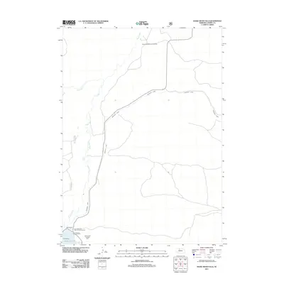
2011 Map of Snake River Falls
USGS Topo · Published 2011About this map
The Snake River winds through the Nebraska Sandhills in this 2011 survey, carving a path toward the notable Snake River Falls. The landscape is defined by the massive Merritt Reservoir and the engineering of the Merritt Dam, which regulates the flow into the extensive Ainsworth Canal system. This irrigation infrastructure transformed the regional water management for Cherry County, supporting both agricultural needs and recreation. Visitors and locals utilize the Merritt Reservoir Main Area Campground and the Merritt Trading Post and RV Park near the water's edge. Aviation is supported by local infrastructure like the Flying Diamond Landing Strip and the Merritt Dam Landing Strip, while Falls Bridge provides a crossing near the river's namesake drop. The map highlights the balance between the natural watercourse of Steer Creek and the man-made water distribution network that dominates the terrain.
Find a feature on this map
12 named features on this map. Tap any name to fly to it.
Don’t see what you’re looking for? This feature index may not catch every label — zoom into the map to look around manually.
Map Details
Editions of this 2011 Snake River Falls Map
This is the sole edition of this map. No revisions or reprints were ever made.
Other maps of this area

1950 · Simeon
USGS Topo · 1:62,500

1950 · Kennedy
USGS Topo · 1:62,500

1950 · Kilgore
USGS Topo · 1:62,500

1950 · Valentine
USGS Topo · 1:62,500

1957 · Valentine
USGS Topo · 1:250,000

1959 · Valentine
USGS Topo · 1:250,000

1983 · Valentine SW
USGS Topo · 1:24,000
1985 · Kilgore SE
USGS Topo · 1:24,000

1985 · Cooper Canyon
USGS Topo · 1:24,000
1985 · Windmill Lake
USGS Topo · 1:24,000