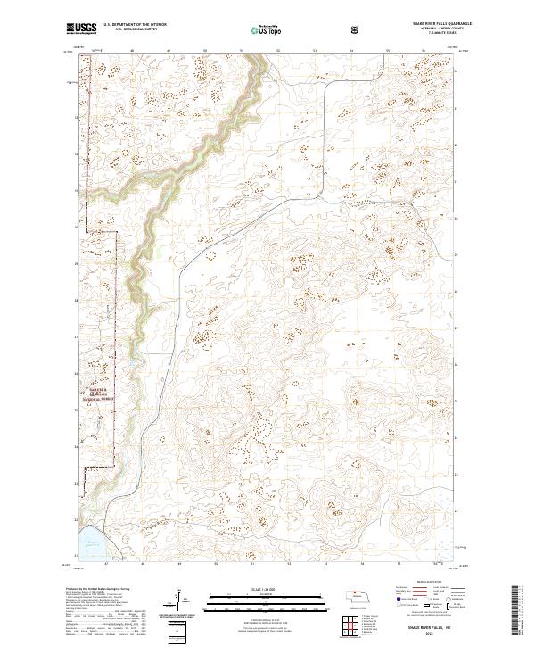
2021 Map of Snake River Falls
USGS Topo · Published 2021About this map
Snake River Falls provides a dramatic focal point in this portion of the Nebraska Sandhills, where the waters of the Snake River cut through the high prairie. The landscape is defined by its water management and conservation boundaries, with the northern reaches of the Merritt Reservoir and the start of the Ainsworth Canal illustrating the region's 20th-century irrigation heritage. Large sections of the western terrain fall within the Samuel R McKelvie National Forest, highlighting the area's transition from open range to protected timber and grassland. Tracing the path of Steer Cr and various local routes like Pr Dr, the map reveals a sparsely settled but highly organized grid of township boundaries, including t32n r30w and t31n r29w, which reflect the enduring legal geography of Cherry County.
Find a feature on this map
11 named features on this map. Tap any name to fly to it.
Don’t see what you’re looking for? This feature index may not catch every label — zoom into the map to look around manually.
Map Details
Editions of this 2021 Snake River Falls Map
This is the sole edition of this map. No revisions or reprints were ever made.
Other maps of this area

1950 · Simeon
USGS Topo · 1:62,500

1950 · Kennedy
USGS Topo · 1:62,500

1950 · Kilgore
USGS Topo · 1:62,500

1950 · Valentine
USGS Topo · 1:62,500

1957 · Valentine
USGS Topo · 1:250,000

1959 · Valentine
USGS Topo · 1:250,000

1983 · Valentine SW
USGS Topo · 1:24,000
1985 · Kilgore SE
USGS Topo · 1:24,000

1985 · Cooper Canyon
USGS Topo · 1:24,000
1985 · Windmill Lake
USGS Topo · 1:24,000