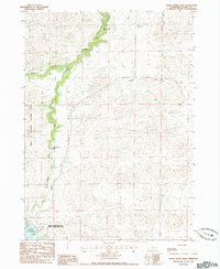
1985 Map of Snake River Falls
USGS Topo · Published 1985About this map
Snake River Falls defines this Nebraska landscape, where the Snake River carves a deep, winding path through the sand hills of Cherry County. The northern reaches of the Merritt Reservoir dominate the southwestern corner, surrounded by the Merritt Reservoir State Wildlife Management Area. This mid-1980s data highlights a sparsely populated region primarily managed for conservation and ranching, evidenced by the western boundary of the Samuel R Mc Kelvie National Forest. Human infrastructure is light, represented by remote outposts like the Tioga-Burge Sch and small private runways including the Flying Diamond Landing Strip. Water management is a visible priority for the era, with the Ainsworth Canal cutting across the terrain to move water from the reservoir system to distant agricultural fields.
Find a feature on this map
12 named features on this map. Tap any name to fly to it.
Don’t see what you’re looking for? This feature index may not catch every label — zoom into the map to look around manually.
Map Details
Editions of this 1985 Snake River Falls Map
This is the sole edition of this map. No revisions or reprints were ever made.
Other maps of this area

1950 · Simeon
USGS Topo · 1:62,500

1950 · Kennedy
USGS Topo · 1:62,500

1950 · Kilgore
USGS Topo · 1:62,500

1950 · Valentine
USGS Topo · 1:62,500

1957 · Valentine
USGS Topo · 1:250,000

1959 · Valentine
USGS Topo · 1:250,000

1983 · Valentine SW
USGS Topo · 1:24,000
1985 · Kilgore SE
USGS Topo · 1:24,000

1985 · Cooper Canyon
USGS Topo · 1:24,000
1985 · Windmill Lake
USGS Topo · 1:24,000