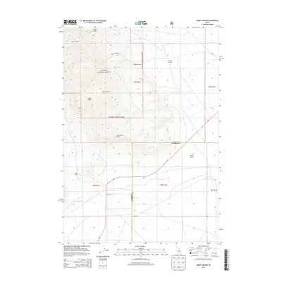
2013 Map of Snaky Canyon
USGS Topo · Published 2013About this map
Reno Ranch stands as a primary point of human settlement in this high-desert landscape, situated where the terrain transitions from the steep drainage systems of the Targhee National Forest to more level plains. The northern portion of the map is defined by a series of deep incisions in the earth, including the eponymous Snaky Canyon, Kelly Canyon, and Corral Canyon. This area shows the intersection of wild timberland and agricultural effort, evidenced by the Reno Ditch which carries water toward the lower elevations. Travel through this portion of the Jefferson and Clark county line is facilitated by the curving path of Id-22 and the unpaved Snaky Canyon Rd, while landmarks like Rattlesnake Point and Juniper Gulch provide distinct navigational markers for those tracing the historical geography of this Idaho backcountry.
Find a feature on this map
18 named features on this map. Tap any name to fly to it.
Don’t see what you’re looking for? This feature index may not catch every label — zoom into the map to look around manually.
Map Details
Editions of this 2013 Snaky Canyon Map
This is the sole edition of this map. No revisions or reprints were ever made.
Other maps of this area

1955 · Dubois
USGS Topo · 1:250,000

1955 · Idaho Falls
USGS Topo · 1:250,000

1958 · Dubois
USGS Topo · 1:250,000

1958 · Idaho Falls
USGS Topo · 1:250,000

1969 · Shamrock Gulch
USGS Topo · 1:24,000

1969 · Lidy Hot Springs SE
USGS Topo · 1:24,000

1969 · Circular Butte NW
USGS Topo · 1:24,000

1969 · Richard Butte
USGS Topo · 1:24,000

1969 · Copper Mtn
USGS Topo · 1:24,000

1969 · Lidy Hot Springs
USGS Topo · 1:24,000