
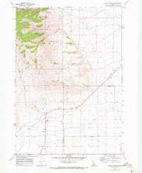
1969 Map of Lidy Hot Springs
USGS Topo · Published 1973About this map
Lidy Hot Springs and the surrounding high country of Clark County are defined by a network of geothermal and seasonal water sources. In this late 1960s survey, the area south of Maud Mtn reveals a landscape punctuated by numerous water features, including Stinking Spring, Antelope Spring, and Three Springs. The drainage patterns are clearly visible through Warm Springs Creek and Blue Creek, which descend from the higher elevations toward the valley floor.
Find a feature on this map
15 named features on this map. Tap any name to fly to it.
Don’t see what you’re looking for? This feature index may not catch every label — zoom into the map to look around manually.
Map Details
Editions of this 1969 Lidy Hot Springs Map
This is the sole edition of this map. No revisions or reprints were ever made.
Other maps of this area

1955 · Dubois
USGS Topo · 1:250,000

1957 · Paul Reservoir
USGS Topo · 1:62,500

1957 · Edie Ranch
USGS Topo · 1:62,500

1958 · Dubois
USGS Topo · 1:250,000

1964 · Small
USGS Topo · 1:24,000

1964 · Cedar Butte SW
USGS Topo · 1:24,000

1969 · Shamrock Gulch
USGS Topo · 1:24,000

1969 · Lidy Hot Springs SE
USGS Topo · 1:24,000
1969 · Snaky Canyon
USGS Topo · 1:24,000

1983 · Dubois
USGS Topo · 1:100,000