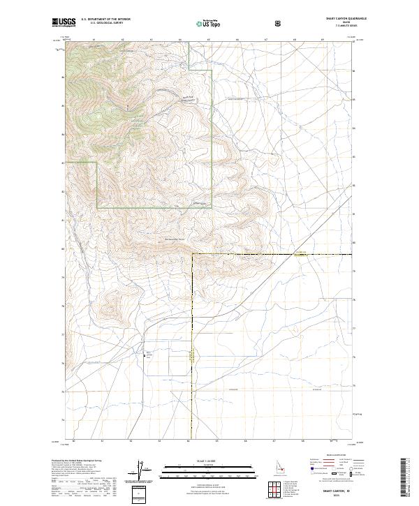
2023 Map of Snaky Canyon
USGS Topo · Published 2023About this map
Reno Pioneer Cem sits at the edge of the irrigation network defined by Reno Ditch, marking a pocket of early settlement history where the plains meet the rising foothills of the Targhee National Forest. The landscape is dominated by a series of deep drainage features, including Snaky Canyon and its northern branch, North Fork Snaky Canyon, which carve through the high ground toward the county line. The transition from agricultural land to protected forest is punctuated by prominent landmarks such as Rattlesnake Point and Kelly Canyon. This 2023 survey illustrates the modern management of these traditional ranching and timber lands, with local routes like Attkins Rd and Snaky Canyon Rd providing access across the complex terrain of Juniper Gulch and Reno Gulch.
Find a feature on this map
19 named features on this map. Tap any name to fly to it.
Don’t see what you’re looking for? This feature index may not catch every label — zoom into the map to look around manually.
Map Details
Editions of this 2023 Snaky Canyon Map
This is the sole edition of this map. No revisions or reprints were ever made.
Other maps of this area

1955 · Dubois
USGS Topo · 1:250,000

1955 · Idaho Falls
USGS Topo · 1:250,000

1958 · Dubois
USGS Topo · 1:250,000

1958 · Idaho Falls
USGS Topo · 1:250,000

1969 · Shamrock Gulch
USGS Topo · 1:24,000

1969 · Lidy Hot Springs SE
USGS Topo · 1:24,000

1969 · Circular Butte NW
USGS Topo · 1:24,000

1969 · Richard Butte
USGS Topo · 1:24,000

1969 · Copper Mtn
USGS Topo · 1:24,000

1969 · Lidy Hot Springs
USGS Topo · 1:24,000