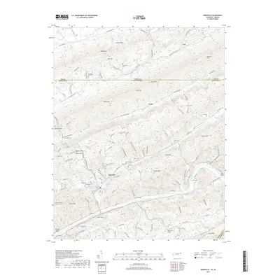
2019 Map of Sneedville
USGS Topo · Published 2019About this map
Sneedville serves as the focal point for this survey of the northern Tennessee borderlands, where the steep topography of the Ridge and Valley province dictates settlement patterns. The community is positioned along the Clinch River, framed by the formidable Newman Ridge and River Knobs. Family history is deeply etched into the landscape, evidenced by numerous small burial grounds such as Harrison Cem, Vanderventer Cem, and De Bord Cem, often situated on the lower slopes of massive landforms like Wallen Ridge and Powell Mtn. To the north, the terrain transitions toward the Virginia state line near the hamlet of Vardy. The map details a complex drainage network including Blackwater Cr and Wallen Creek, illustrating how roads like State Rte 612 follow narrow gaps and hollows to navigate this heavily corrugated corner of Hancock County.
Find a feature on this map
134 named features on this map. Tap any name to fly to it.
Don’t see what you’re looking for? This feature index may not catch every label — zoom into the map to look around manually.
Map Details
Editions of this 2019 Sneedville Map
This is the sole edition of this map. No revisions or reprints were ever made.
Other maps of this area

1883 · Morristown
USGS Topo · 1:125,000

1887 · Jonesville
USGS Topo · 1:125,000

1891 · Jonesville
USGS Topo · 1:125,000

1893 · Morristown
USGS Topo · 1:125,000

1895 · Morristown
USGS Topo · 1:125,000

1932 · Hagan
USGS Topo · 1:62,500

1935 · Rogersville
USGS Topo · 1:48,000

1935 · Tate Springs
USGS Topo · 1:48,000

1935 · Kyles Ford
USGS Topo · 1:24,000

1935 · Lee Valley
USGS Topo · 1:24,000