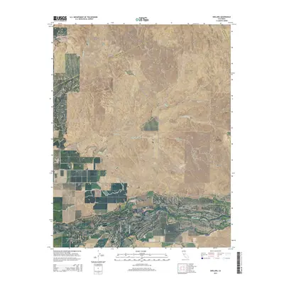
2015 Map of Snelling
USGS Topo · Published 2015About this map
The Snelling townsite sits at the transition from the rolling foothills to the floor of the Central Valley along the banks of the Merced River. This 2015 U.S. Geological Survey representation captures the hydraulic character of the eastern San Joaquin Valley, where intermittent drainage systems like Peaslee Cr and the S Fork Dry Cr converge toward the larger river channel. The landscape is defined by its agricultural and transit infrastructure, with long-established corridors such as La Grange Rd and Merced Falls Rd connecting the settlement to the surrounding ranchland. Regional aviation history is noted by the presence of the Bonanza Hills Airport, situated just east of the main town. The map also delineates the jurisdictional convergence of the Stanislaus and Mariposa county lines along the northern and eastern margins, reflecting the political geography of this Merced County corner.
Find a feature on this map
27 named features on this map. Tap any name to fly to it.
Don’t see what you’re looking for? This feature index may not catch every label — zoom into the map to look around manually.
Map Details
Editions of this 2015 Snelling Map
This is the sole edition of this map. No revisions or reprints were ever made.
Other maps of this area

1893 · Sonora
USGS Topo · 1:125,000

1896 · Sonora
USGS Topo · 1:125,000

1897 · Sonora
USGS Topo · 1:125,000

1898 · Sonora
USGS Topo · 1:125,000

1913 · Dickenson
USGS Topo · 1:31,680

1915 · La Grange
USGS Topo · 1:24,000

1916 · Three Tree Flat
USGS Topo · 1:31,680

1916 · Hopeton
USGS Topo · 1:31,680

1916 · Cooperstown
USGS Topo · 1:31,680

1916 · Merced Falls
USGS Topo · 1:24,000