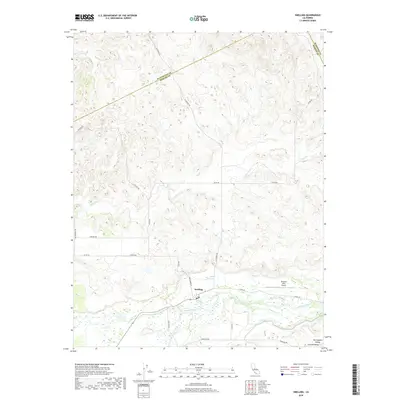
2018 Map of Snelling
USGS Topo · Published 2018About this map
Snelling occupies a central position along the Merced River in this modern topographic study of the San Joaquin Valley Central-Valley. The landscape transitions from the relatively flat river basin near the settlement into the undulating terrain of the Bonanza Hills to the northeast. Transportation and local aviation are central to this area's layout, with the Bonanza Hills Airport situated just east of the main town site. A dense network of rural routes, including La Grange Rd and Keyes Rd, facilitates movement across the township lines. The drainage patterns of the region are clearly defined by Peaslee Cr and the various branches of Dry Cr, which carve through the northern sections of the map before approaching the primary river corridor. This 2018 survey documents the enduring agricultural and rural character of this Merced County community.
Find a feature on this map
27 named features on this map. Tap any name to fly to it.
Don’t see what you’re looking for? This feature index may not catch every label — zoom into the map to look around manually.
Map Details
Editions of this 2018 Snelling Map
This is the sole edition of this map. No revisions or reprints were ever made.
Other maps of this area

1893 · Sonora
USGS Topo · 1:125,000

1896 · Sonora
USGS Topo · 1:125,000

1897 · Sonora
USGS Topo · 1:125,000

1898 · Sonora
USGS Topo · 1:125,000

1913 · Dickenson
USGS Topo · 1:31,680

1915 · La Grange
USGS Topo · 1:24,000

1916 · Three Tree Flat
USGS Topo · 1:31,680

1916 · Hopeton
USGS Topo · 1:31,680

1916 · Cooperstown
USGS Topo · 1:31,680

1916 · Merced Falls
USGS Topo · 1:24,000