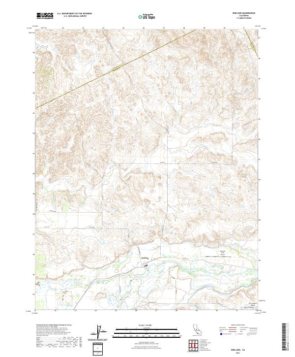
2021 Map of Snelling
USGS Topo · Published 2021About this map
Snelling occupies a strategic position along the northern banks of the Merced River in the heart of the San Joaquin Valley. This modern topographical survey shows a landscape defined by its transition from the irrigated lowlands to the rolling drainage systems of Peaslee Cr and Dry Cr to the north. The area is intersected by a grid of vital rural corridors including La Grande Rd and Co Rd J16, which support the local agricultural economy. To the east of the primary settlement, the Bonanza Hills Airport serves as a distinct landmark in an otherwise agricultural and riparian landscape. The map also delineates several township and range boundaries, such as t5s r14e, and marks the jurisdictional border where Mariposa Co and Merced Co meet.
Find a feature on this map
25 named features on this map. Tap any name to fly to it.
Don’t see what you’re looking for? This feature index may not catch every label — zoom into the map to look around manually.
Map Details
Editions of this 2021 Snelling Map
This is the sole edition of this map. No revisions or reprints were ever made.
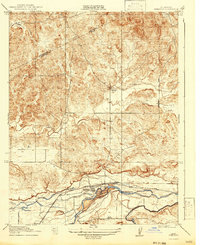
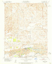
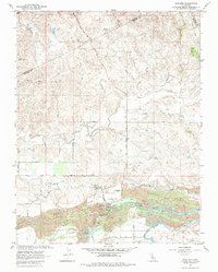
Historical Maps of Mariposa County Through Time
4 maps found