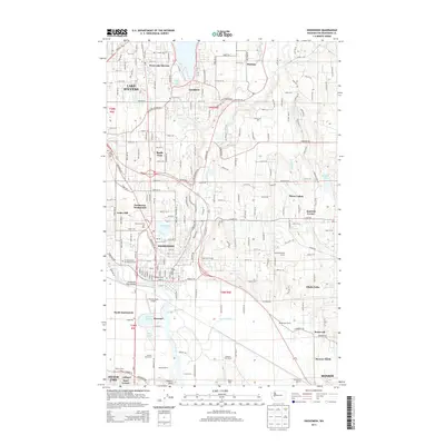
2014 Map of Snohomish
USGS Topo · Published 2014About this map
The Pilchuck River and Snohomish River converge in this Puget Sound lowlands region, anchoring a landscape where historical riverfront development meets modern residential growth. The city of Snohomish is depicted with its core grid and landmarks such as the Grand Army of the Republic Cem and the Snohomish River Bridge. To the south, the floodplains of the Snohomish River are defined by intricate waterways like Hanson Slough and Batt Slough, alongside agricultural holdings such as Bailand Farms and the Antique Rose Farm.
Find a feature on this map
67 named features on this map. Tap any name to fly to it.
Don’t see what you’re looking for? This feature index may not catch every label — zoom into the map to look around manually.
Map Details
Editions of this 2014 Snohomish Map
This is the sole edition of this map. No revisions or reprints were ever made.
Other maps of this area

1895 · Snohomish
USGS Topo · 1:125,000

1897 · Seattle
USGS Topo · 1:125,000

1899 · Stillaguamish
USGS Topo · 1:125,000

1901 · Stilaguamish
USGS Topo · 1:125,000

1911 · Mount Vernon
USGS Topo · 1:125,000

1921 · Sultan
USGS Topo · 1:125,000

1923 · Sultan
USGS Topo · 1:125,000

1941 · Marysville
USGS Topo · 1:62,500

1943 · Marysville
USGS Topo · 1:62,500

1944 · Everett
USGS Topo · 1:62,500