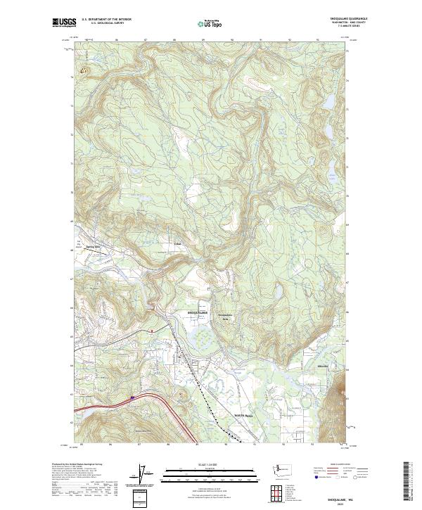
2023 Map of Snoqualmie
USGS Topo · Published 2023About this map
The Snoqualmie River and its major forks converge here, shaping the development of Snoqualmie and North Bend. This 2023 survey illustrates the modern layout of these riverfront communities, highlighting the dramatic geography of Snoqualmie Falls and the surrounding wetland complexes like Meadowbrook Slough and Kimball Creek Swamp. The terrain is dominated by the massive profile of Rattlesnake Mtn to the south, while the northern reaches contain a string of upland water bodies including Kings Lake, Boyle Lake, and Klaus Lake. Smaller settlements and residential pockets such as Tokul, Spring Glen, and Ellisville are mapped alongside a complex network of county roads like Railroad Ave SE and Mill Pond Rd, reflecting the area's transition from its timber-and-rail roots to a contemporary residential and recreation hub.
Find a feature on this map
115 named features on this map. Tap any name to fly to it.
Don’t see what you’re looking for? This feature index may not catch every label — zoom into the map to look around manually.
Map Details
Editions of this 2023 Snoqualmie Map
This is the sole edition of this map. No revisions or reprints were ever made.
Other maps of this area

1913 · Cedar Lake
USGS Topo · 1:125,000

1921 · Sultan
USGS Topo · 1:125,000

1923 · Sultan
USGS Topo · 1:125,000

1953 · Snoqualmie
USGS Topo · 1:24,000

1953 · North Bend
USGS Topo · 1:24,000

1953 · Lake Joy
USGS Topo · 1:24,000

1953 · Hobart
USGS Topo · 1:24,000

1953 · Fall City
USGS Topo · 1:24,000

1953 · Carnation
USGS Topo · 1:24,000

1957 · Wenatchee
USGS Topo · 1:250,000