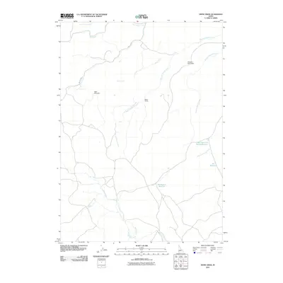
2010 Map of Snow Creek
USGS Topo · Published 2010About this map
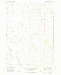
Bald Mountain rises as a prominent landmark in this high-desert drainage system, where water management is central to the landscape. The intricate network of the West Fork Shoofly Creek and East Fork Shoofly Creek defines the terrain, converging near the distinctive area known as Between the Creeks. This survey documents a critical infrastructure of upland water storage, featuring the Upper East Fork Shoofly Reservoir, Elk Reservoir, and Big Sagehen Reservoir. These reservoirs, connected by intermittent flows like Bottle Creek and Snow Creek, reflect the essential ranching and irrigation needs of Owyhee County. The passage of Mud Flat Rd provides the primary transit through these drainages, while northern boundary features like Lone Juniper Creek and Fall Creek highlight the isolated nature of these high-elevation basins.
Find a feature on this map
14 named features on this map. Tap any name to fly to it.
Don’t see what you’re looking for? This feature index may not catch every label — zoom into the map to look around manually.
Map Details
Editions of this 2010 Snow Creek Map
This is the sole edition of this map. No revisions or reprints were ever made.
Other maps of this area

1947 · Grand View
USGS Topo · 1:62,500

1947 · Perjue Canyon
USGS Topo · 1:24,000

1948 · Perjue Canyon
USGS Topo · 1:24,000

1955 · Jordan Valley
USGS Topo · 1:250,000

1957 · Jordan Valley
USGS Topo · 1:250,000

1958 · Jordan Valley
USGS Topo · 1:250,000
1972 · Rough Mountain
USGS Topo · 1:24,000
1972 · Pixley Basin
USGS Topo · 1:24,000
1972 · Big Springs Ranch
USGS Topo · 1:24,000
1972 · Crab Spring Butte
USGS Topo · 1:24,000