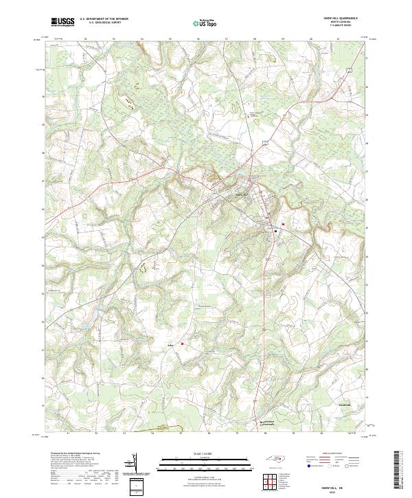
2022 Map of Snow Hill
USGS Topo · Published 2022About this map
Contentnea Creek winds through the heart of this landscape, anchoring the historic county seat of Snow Hill. The town is defined by its central Greene County Courthouse and educational landmarks like the Lenoir Community College - Snow Hill. The surrounding rural territory is a complex network of wetlands and small agricultural communities, featuring the expansive Tyson Marsh and the distinctive Beargarden Pocosin to the north. These natural features dictated the early settlement patterns of the region, where small crossroads and hamlets like Arba, Browntown Crossroads, and Glenfield emerged along high ground. Family history is etched into the landscape at sites like Snow Hill Cem and Rainbow Cem, while the industrial past of the local waterways is marked by Turnage Millpond along the western reaches of Jacks Fork.
Find a feature on this map
101 named features on this map. Tap any name to fly to it.
Don’t see what you’re looking for? This feature index may not catch every label — zoom into the map to look around manually.
Map Details
Editions of this 2022 Snow Hill Map
This is the sole edition of this map. No revisions or reprints were ever made.
Other maps of this area

1904 · Falkland
USGS Topo · 1:62,500

1904 · Wilson
USGS Topo · 1:62,500

1914 · Kinston
USGS Topo · 1:48,000

1916 · Kinston
USGS Topo · 1:62,500

1953 · Rocky Mount
USGS Topo · 1:250,000

1954 · Rocky Mount
USGS Topo · 1:250,000

1957 · Goldsboro
USGS Topo · 1:62,500
1978 · Stantonsburg
USGS Topo · 1:24,000
1981 · Farmville
USGS Topo · 1:24,000
1981 · Walstonburg
USGS Topo · 1:24,000