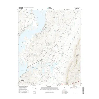
2016 Map of Snow Hill
USGS Topo · Published 2016About this map
Harrison Bay and the interconnected waters of Dallas Lake dominate the western landscape of this Hamilton County region. The topography rises sharply from the basin of Savannah Bay toward the prominent ridge of White Oak Mountain along the eastern border. This transition from waterfront to upland terrain is marked by numerous family-named landmarks and cemeteries, suggesting a deep-rooted lineage of land ownership. Settlements like Snow Hill and Blue Springs serve as focal points for the surrounding rural residential development, while smaller features like Skull Island and Rabbit Island punctuate the inlets of the Wolftever Creek drainage. The map reveals an intricate network of landings and ferry sites, including Olde Ferry Lndg, which point to a history of river-based transportation that shaped the area's development before modern infrastructure.
Find a feature on this map
210 named features on this map. Tap any name to fly to it.
Don’t see what you’re looking for? This feature index may not catch every label — zoom into the map to look around manually.
Map Details
Editions of this 2016 Snow Hill Map
This is the sole edition of this map. No revisions or reprints were ever made.
Other maps of this area

1886 · Cleveland
USGS Topo · 1:125,000

1888 · Chattanooga
USGS Topo · 1:125,000

1892 · Cleveland
USGS Topo · 1:125,000

1893 · Chattanooga
USGS Topo · 1:125,000

1895 · Cleveland
USGS Topo · 1:125,000

1901 · Cleveland
USGS Topo · 1:125,000

1935 · East Chattanooga
USGS Topo · 1:24,000

1935 · Daisy
USGS Topo · 1:24,000

1935 · Mc Donald
USGS Topo · 1:24,000

1935 · Soddy
USGS Topo · 1:24,000