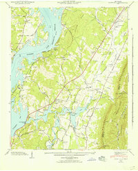
1942 Map of Snow Hill
USGS Topo · Published 1954About this map
The rising waters of the Chickamauga Reservoir dominate this 1940s landscape, reflecting the massive transformation of the Tennessee River valley by the Tennessee Valley Authority. The map details the newly formed Harrison Bay and the establishment of Harrison Bay State Park, while preserving the locations of earlier farmsteads and rural infrastructure. A high density of family burial grounds, including the Penny Cem, Masterson Cem, and Igou Cem, provides a detailed record for genealogical research in this part of Hamilton County.
Find a feature on this map
64 named features on this map. Tap any name to fly to it.
Don’t see what you’re looking for? This feature index may not catch every label — zoom into the map to look around manually.
Map Details
Editions of this 1942 Snow Hill Map
This is the sole edition of this map. No revisions or reprints were ever made.
Other maps of this area

1886 · Cleveland
USGS Topo · 1:125,000

1888 · Chattanooga
USGS Topo · 1:125,000

1892 · Cleveland
USGS Topo · 1:125,000

1893 · Chattanooga
USGS Topo · 1:125,000

1895 · Cleveland
USGS Topo · 1:125,000

1901 · Cleveland
USGS Topo · 1:125,000

1935 · East Chattanooga
USGS Topo · 1:24,000

1935 · Daisy
USGS Topo · 1:24,000

1935 · Mc Donald
USGS Topo · 1:24,000

1935 · Soddy
USGS Topo · 1:24,000