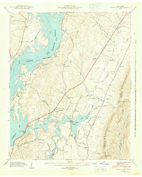
1943 Map of Snow Hill
USGS Topo · Published 1943About this map
Chickamauga Reservoir dominates the western landscape of this 1943 survey, its waters reaching into the many coves and inlets of Harrison Bay. The map captures the shoreline during the early years of the reservoir's existence, showing the Reservation Boundary that separates the newly created Harrison Bay State Park from the surrounding rural community. Inland, the terrain is defined by the prominent White Oak Mountain and Dividing Ridge, which hem in a network of small creeks and valleys.
Find a feature on this map
112 named features on this map. Tap any name to fly to it.
Don’t see what you’re looking for? This feature index may not catch every label — zoom into the map to look around manually.
Map Details
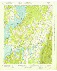
Editions of this 1943 Snow Hill Map
2 editions found
Other maps of this area

1886 · Cleveland
USGS Topo · 1:125,000

1888 · Chattanooga
USGS Topo · 1:125,000

1892 · Cleveland
USGS Topo · 1:125,000

1893 · Chattanooga
USGS Topo · 1:125,000

1895 · Cleveland
USGS Topo · 1:125,000

1901 · Cleveland
USGS Topo · 1:125,000

1935 · East Chattanooga
USGS Topo · 1:24,000

1935 · Daisy
USGS Topo · 1:24,000

1935 · Mc Donald
USGS Topo · 1:24,000

1935 · Soddy
USGS Topo · 1:24,000