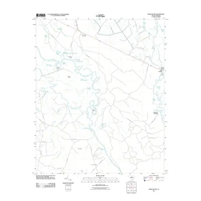
2011 Map of Snow Island
USGS Topo · Published 2011About this map
Snow Island dominates this low-country landscape where the Great Pee Dee River and Little Pee Dee River converge. This 2011 survey reveals a complex network of wetlands and oxbow lakes, such as Horseshoe Lake and Old River Lake, which define the Marion County terrain. The river-dependent character of the region is evident in the presence of Sampson Landing and Pitch Landing, while the Potatoe Bed Ferry Bridge provides a vital link across the waterways.
Find a feature on this map
64 named features on this map. Tap any name to fly to it.
Don’t see what you’re looking for? This feature index may not catch every label — zoom into the map to look around manually.
Map Details
Editions of this 2011 Snow Island Map
This is the sole edition of this map. No revisions or reprints were ever made.
Other maps of this area

1943 · Yauhannah
USGS Topo · 1:24,000

1943 · Henry
USGS Topo · 1:24,000

1943 · Dongola
USGS Topo · 1:24,000

1943 · Horry
USGS Topo · 1:24,000

1943 · Outland
USGS Topo · 1:24,000

1944 · Outland
USGS Topo · 1:31,680

1946 · Johnsonville
USGS Topo · 1:62,500

1949 · Georgetown
USGS Topo · 1:250,000

1967 · Georgetown
USGS Topo · 1:250,000

1974 · Georgetown
USGS Topo · 1:250,000