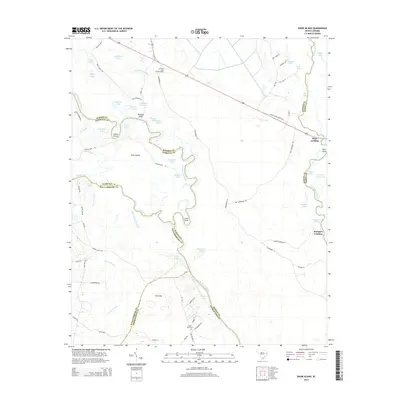
2014 Map of Snow Island
USGS Topo · Published 2014About this map
The Great Pee Dee River winds through a complex network of wetlands and riverine forests where the borders of Marion, Florence, Williamsburg, Georgetown, and Horry counties converge. This river-dominated landscape is defined by its deep connectivity to the water, featuring Snow Island and the confluence of the Lynches River and Little Pee Dee River. The placement of Sampson Landing and Pitch Landing along these banks points to the area's long history as a point of transit and river commerce.
Find a feature on this map
81 named features on this map. Tap any name to fly to it.
Don’t see what you’re looking for? This feature index may not catch every label — zoom into the map to look around manually.
Map Details
Editions of this 2014 Snow Island Map
This is the sole edition of this map. No revisions or reprints were ever made.
Other maps of this area

1943 · Yauhannah
USGS Topo · 1:24,000

1943 · Henry
USGS Topo · 1:24,000

1943 · Dongola
USGS Topo · 1:24,000

1943 · Horry
USGS Topo · 1:24,000

1943 · Outland
USGS Topo · 1:24,000

1944 · Outland
USGS Topo · 1:31,680

1946 · Johnsonville
USGS Topo · 1:62,500

1949 · Georgetown
USGS Topo · 1:250,000

1967 · Georgetown
USGS Topo · 1:250,000

1974 · Georgetown
USGS Topo · 1:250,000