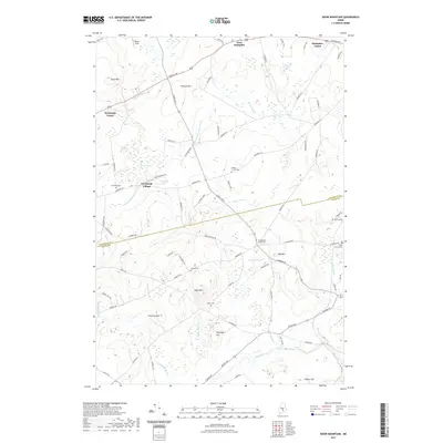
2021 Map of Snow Mountain
USGS Topo · Published 2021About this map
Newburgh Village and Newburgh Center serve as primary anchors for this inland Maine landscape where the Penobscot and Waldo county line cuts through agricultural and wooded terrain. The area is defined by a network of drainage systems including the W Br Souadabscook Stream and E Br Souadabscook Stream, which wind between significant elevations like Snow Mtn and Pickard Hill. Numerous small burial grounds, such as Neallys Corner Cem and Ellingwood Corner Cem, are dispersed along historical transit corridors like Kennebec Rd and Western Ave. These cemeteries, often associated with specific family names like Perkins and Twining, provide essential physical evidence of early settlement patterns and genealogical heritage in the region between West Hampden and the town of Newburgh.
Find a feature on this map
79 named features on this map. Tap any name to fly to it.
Don’t see what you’re looking for? This feature index may not catch every label — zoom into the map to look around manually.
Map Details
Editions of this 2021 Snow Mountain Map
This is the sole edition of this map. No revisions or reprints were ever made.
Other maps of this area

1900 · Bucksport
USGS Topo · 1:62,500

1902 · Bucksport
USGS Topo · 1:62,500

1902 · Bangor
USGS Topo · 1:62,500

1931 · Stetson
USGS Topo · 1:48,000

1932 · Brooks
USGS Topo · 1:62,500

1935 · Stetson
USGS Topo · 1:62,500

1942 · Bangor
USGS Topo · 1:62,500

1942 · Bucksport
USGS Topo · 1:62,500

1946 · Bangor
USGS Topo · 1:62,500

1948 · Bangor
USGS Topo · 1:250,000