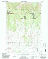
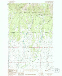
1995 Map of Snow Saucer Coulee
USGS Topo · Published 1997About this map
The Snowy Mountains dominate this 1990s landscape, where the northern timbered slopes of the Lewis and Clark National Forest give way to the drainage systems of the Musselshell basin. A network of coulees, including Snow Saucer Coulee and Tepee Coulee, defines the transition from high-elevation forest to the open grasslands of the Musselshell Ranger District. This map captures the intricate hydrology of the region as it appeared in the mid-1990s, tracing the headwaters of the West Fork Big Snowy Creek and the southern flow of Careless Creek and Little Careless Creek. These watercourses provided the essential lifelines for ranching operations in Wheatland and Golden Valley counties. A prominent east-west pipeline and numerous spring sites further reveal the infrastructure required to manage water and resources across this high-plains environment.
Find a feature on this map
32 named features on this map. Tap any name to fly to it.
Don’t see what you’re looking for? This feature index may not catch every label — zoom into the map to look around manually.
Map Details
Editions of this 1995 Snow Saucer Coulee Map
This is the sole edition of this map. No revisions or reprints were ever made.
Other maps of this area

1889 · Big Snowy Mountain
USGS Topo · 1:250,000

1893 · Big Snowy Mountain
USGS Topo · 1:250,000

1954 · Roundup
USGS Topo · 1:250,000

1958 · Roundup
USGS Topo · 1:250,000

1970 · Crystal Lake
USGS Topo · 1:24,000
1970 · Half Moon Canyon
USGS Topo · 1:24,000
1970 · Jump Off Peak
USGS Topo · 1:24,000
1986 · Yaple Bench
USGS Topo · 1:24,000
1986 · Snow Saucer Coulee
USGS Topo · 1:24,000

1986 · Halbert Creek North
USGS Topo · 1:24,000