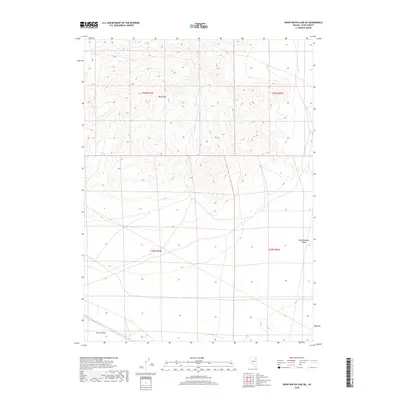
2018 Map of Snow Water Lake NE
USGS Topo · Published 2018About this map
Wood Hills dominates the northern half of this landscape, characterized by complex topographic contours that give way to the expansive basins of Independence Valley and Clover Valley to the south and southeast. This 2018 survey reveals a terrain defined primarily by its natural drainage patterns and the open spaces between these prominent geographical features. The transition from the high ground of the Wood Hills to the valley floors suggests a classic Great Basin environment where water movement is dictated by the steep gradients of the hillsides. With very few man-made structures or developed roads noted, the map serves as a clear record of the physical geography and the vast, open character of this section of Elko County, focused on the natural landforms that define the area.
Find a feature on this map
7 named features on this map. Tap any name to fly to it.
Don’t see what you’re looking for? This feature index may not catch every label — zoom into the map to look around manually.
Map Details
Editions of this 2018 Snow Water Lake NE Map
This is the sole edition of this map. No revisions or reprints were ever made.
Other maps of this area

1955 · Wells
USGS Topo · 1:250,000

1955 · Elko
USGS Topo · 1:250,000

1958 · Wells
USGS Topo · 1:250,000

1958 · Elko
USGS Topo · 1:250,000

1961 · Wells
USGS Topo · 1:250,000

1962 · Elko
USGS Topo · 1:250,000

1965 · Elko
USGS Topo · 1:250,000

1968 · Moor Summit
USGS Topo · 1:24,000

1968 · Independence Valley SW
USGS Topo · 1:24,000

1968 · Wells
USGS Topo · 1:24,000