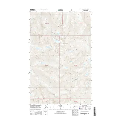
2014 Map of Snowking Mountain
USGS Topo · Published 2014About this map
Snowking Mtn dominates the high-altitude landscape of this part of the Mount Baker National Forest in Washington. The terrain is defined by a dense concentration of alpine water bodies, including the tiered Upper Jordan Lake and Lower Jordan Lake systems, and the clustered Upper Granite Lake and Lower Granite Lake. These features reflect a glacial geography where high ridges like Razorback Mtn and Mt Chaval separate deep drainages. Multiple watercourses such as Illabot Cr, Jordan Cr, and Found Cr descend from these peaks, illustrating the complex hydrological network of the North Cascades. For the researcher, the map captures the wilderness state of the forest in the early twenty-first century, showing the remote locations of Slide Lake, Cyclone Lake, and Whale Lake far from established road networks, emphasizing the area's character as a high-mountain preserve.
Find a feature on this map
41 named features on this map. Tap any name to fly to it.
Don’t see what you’re looking for? This feature index may not catch every label — zoom into the map to look around manually.
Map Details
Editions of this 2014 Snowking Mountain Map
This is the sole edition of this map. No revisions or reprints were ever made.
Other maps of this area

1899 · Glacier Peak
USGS Topo · 1:125,000

1901 · Glacier Peak
USGS Topo · 1:125,000

1953 · Marblemount
USGS Topo · 1:62,500

1955 · Concrete
USGS Topo · 1:250,000

1958 · Concrete
USGS Topo · 1:250,000

1962 · Concrete
USGS Topo · 1:250,000

1963 · Sonny Boy Lakes
USGS Topo · 1:24,000

1963 · Eldorado Peak
USGS Topo · 1:24,000
1963 · Downey Mtn
USGS Topo · 1:24,000
1966 · Snowking Mtn.
USGS Topo · 1:24,000