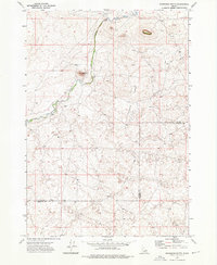
1972 Map of Snowshoe Butte
USGS Topo · Published 1976About this map
Camas Creek winds through this high-altitude section of the Snake River Plain, creating a narrow corridor of vegetation amidst a landscape defined by volcanic landforms. The terrain is dominated by the prominent Snowshoe Butte and the long elevation of Chicken Ridge, which runs north to south through the center of the sheet. This 1972 survey highlights the remote character of the border between Clark and Fremont counties, where human activity is limited to a sparse network of unimproved roads and a Jeep Trail. Geological features are a primary focus, with several identified Caves and a single Cave noted in the northern sections, likely reflecting the basaltic nature of the region. The absence of settlements and the presence of a lone Well emphasize the area's primary use for seasonal grazing or resource management rather than permanent habitation.
Find a feature on this map
9 named features on this map. Tap any name to fly to it.
Don’t see what you’re looking for? This feature index may not catch every label — zoom into the map to look around manually.
Map Details
Editions of this 1972 Snowshoe Butte Map
This is the sole edition of this map. No revisions or reprints were ever made.
Other maps of this area

1955 · Dubois
USGS Topo · 1:250,000

1955 · Ashton
USGS Topo · 1:250,000

1958 · Dubois
USGS Topo · 1:250,000

1958 · Ashton
USGS Topo · 1:250,000

1960 · Ashton
USGS Topo · 1:250,000

1964 · Dubois NE
USGS Topo · 1:24,000
1964 · Dubois SE
USGS Topo · 1:24,000

1972 · Pine Butte
USGS Topo · 1:24,000
1972 · Split Rock
USGS Topo · 1:24,000
1972 · Big Grassy Ridge SE
USGS Topo · 1:24,000