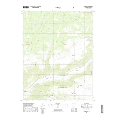
2019 Map of Snyder Flats
USGS Topo · Published 2019About this map
Unaweep Canyon and the Unaweep Divide anchor the central landscape of this western Colorado survey, where the high plateaus of the Grand Mesa National Forest meet the Uncompahgre National Forest. The map documents a complex water management system through a series of numbered catchments, including King Reservoir Number 1 and Gobbo Reservoir Number 1, alongside natural features like Enochs Lake. Local history and industry are represented by Gill Spur and the grazing lands of Gill Meadows, while the topography is punctuated by sharp landmarks such as Thimble Rock Point and Thimble Point. The drainage patterns of Johnson Cr and Snyder Cr illustrate the rugged transitions between the flats and the steep gulches of the Uncompahgre front.
Find a feature on this map
43 named features on this map. Tap any name to fly to it.
Don’t see what you’re looking for? This feature index may not catch every label — zoom into the map to look around manually.
Map Details
Editions of this 2019 Snyder Flats Map
This is the sole edition of this map. No revisions or reprints were ever made.
Other maps of this area

1950 · Pine Mountain
USGS Topo · 1:24,000

1956 · Moab
USGS Topo · 1:250,000

1959 · Moab
USGS Topo · 1:250,000

1960 · Moab
USGS Topo · 1:250,000
1960 · Gateway
USGS Topo · 1:62,500
1960 · Pine Mountain
USGS Topo · 1:24,000

1962 · Moab
USGS Topo · 1:250,000

1964 · Moab
USGS Topo · 1:250,000

1965 · Moab
USGS Topo · 1:250,000
1969 · Glade Park
USGS Topo · 1:24,000