
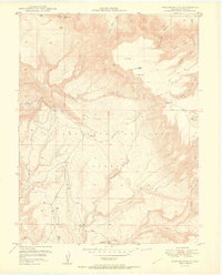
1950 Map of Pine Mountain
USGS Topo · Published 1950About this map
The Uncompahgre National Forest dominates this mid-century topographical study, reflecting a landscape defined by deep canyons and high plateaus. The topography is intricately detailed, showing the complex drainage systems of Calamity Creek and Cow Creek as they cut through the Mesa County terrain. Notable high points like Pine Mountain and Wolf Hill provide structural anchors for the map, while several livestock-related water features such as Rim Pond and Big Pond suggest the ranching utility of this high-country acreage. Remote access is documented through the Snowshoe Trail and Basin Trail, which navigate the steep descents into Yellowjacket Canyon and North Fork Canyon. This map was produced in cooperation with the United States Atomic Energy Commission, an unusual collaboration that highlights the era's focus on mineral exploration and strategic resource mapping in the Western United States.
Find a feature on this map
28 named features on this map. Tap any name to fly to it.
Don’t see what you’re looking for? This feature index may not catch every label — zoom into the map to look around manually.
Map Details
Editions of this 1950 Pine Mountain Map
2 editions found
Other maps of this area

1949 · Juanita Arch
USGS Topo · 1:24,000

1949 · Calamity Mesa
USGS Topo · 1:24,000

1949 · Gateway
USGS Topo · 1:24,000

1950 · Juanita Arch
USGS Topo · 1:24,000

1950 · Calamity Mesa
USGS Topo · 1:24,000

1952 · Gateway
USGS Topo · 1:24,000

1956 · Moab
USGS Topo · 1:250,000

1959 · Moab
USGS Topo · 1:250,000

1960 · Moab
USGS Topo · 1:250,000
1960 · Gateway
USGS Topo · 1:62,500