
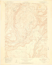
1950 Map of Calamity Mesa
USGS Topo · Published 1950About this map
The Atomic Energy Commission and the Geological Survey collaborated on this mid-century study of a critical mining landscape in Mesa County. Calamity Mesa and Outlaw Mesa dominate the topography, revealing a network of remote mining operations such as the Hidden Treasure Mine and Small Spot Mine. These sites, along with the simply labeled Mines found throughout the Uncompahgre National Forest, point to the post-war uranium and vanadium boom that transformed this part of Colorado. Settlements here are transient and industrial in nature, represented by Calamity Camp and Outlaw Camp, which served the labor force extracting minerals from the steep drainages of Calamity Creek and Blue Creek. The map provides a precise record of the road networks and primitive trails required to service these high-altitude claims during the height of the Cold War mineral rush.
Find a feature on this map
25 named features on this map. Tap any name to fly to it.
Don’t see what you’re looking for? This feature index may not catch every label — zoom into the map to look around manually.
Map Details
Editions of this 1950 Calamity Mesa Map
2 editions found
Other maps of this area

1916 · Paradox Valley
USGS Topo · 1:125,000

1922 · Paradox Valley
USGS Topo · 1:125,000

1948 · Roc Creek
USGS Topo · 1:24,000

1949 · Roc Creek
USGS Topo · 1:24,000

1949 · Juanita Arch
USGS Topo · 1:24,000

1949 · Atkinson Creek
USGS Topo · 1:24,000

1949 · Red Canyon
USGS Topo · 1:24,000

1949 · Calamity Mesa
USGS Topo · 1:24,000

1949 · Gateway
USGS Topo · 1:24,000

1950 · Juanita Arch
USGS Topo · 1:24,000