
1952 Map of Gateway
USGS Topo · Published 1952About this map
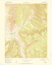
Gateway occupies a narrow junction of canyons where the Dolores River meets the drainages of the high mesa country. Produced during a period of intense mineral exploration in western Colorado, this map was published in cooperation with the United States Atomic Energy Commission, reflecting the area's significance for uranium and vanadium production. The rugged topography is defined by deep incisions like John Brown Canyon and Lumsden Canyon, while the soaring profile of The Palisade dominates the northern horizon.
Find a feature on this map
30 named features on this map. Tap any name to fly to it.
Don’t see what you’re looking for? This feature index may not catch every label — zoom into the map to look around manually.
Map Details
Editions of this 1952 Gateway Map
2 editions found
Other maps of this area

1885 · La Sal
USGS Topo · 1:250,000

1949 · Juanita Arch
USGS Topo · 1:24,000

1949 · Calamity Mesa
USGS Topo · 1:24,000

1949 · Gateway
USGS Topo · 1:24,000

1950 · Juanita Arch
USGS Topo · 1:24,000

1950 · Calamity Mesa
USGS Topo · 1:24,000

1950 · Pine Mountain
USGS Topo · 1:24,000

1954 · Mt. Waas 4 SE
USGS Topo · 1:24,000

1954 · Mt. Waas 4 NE
USGS Topo · 1:24,000

1954 · Mt. Waas 1 SE
USGS Topo · 1:24,000