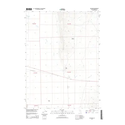
2015 Map of Sod House
USGS Topo · Published 2015About this map
The Quinn River meanders through the arid expanse of Desert Valley in this remote section of northern Nevada. This landscape is defined by the contrast between the flat valley floor and the rising slopes of the Double H Mountains, which dominate the eastern portion of the quadrangle. The namesake settlement of Sod House sits near the base of Sod House Point, a prominent geographic feature overlooking the river's winding path. Historical transport routes such as the Old Winnemucca-Denio Rd and Sod House Rd intersect the terrain, providing essential passage through this sparsely populated high-desert region. Further north, the Quinn River Lakes and Cheietto Spring serve as critical water points in an otherwise thirsty environment, illustrating the importance of natural hydrology to local settlement and land use.
Find a feature on this map
15 named features on this map. Tap any name to fly to it.
Don’t see what you’re looking for? This feature index may not catch every label — zoom into the map to look around manually.
Map Details
Editions of this 2015 Sod House Map
This is the sole edition of this map. No revisions or reprints were ever made.
Other maps of this area

1882 · Paradise
USGS Topo · 1:250,000

1886 · Disaster
USGS Topo · 1:250,000

1893 · Paradise
USGS Topo · 1:250,000

1893 · Disaster
USGS Topo · 1:250,000

1954 · Vya
USGS Topo · 1:250,000

1955 · McDermitt
USGS Topo · 1:250,000

1958 · Vya
USGS Topo · 1:250,000

1958 · Awakening Peak
USGS Topo · 1:62,500

1959 · McDermitt
USGS Topo · 1:250,000

1959 · Orovada
USGS Topo · 1:62,500