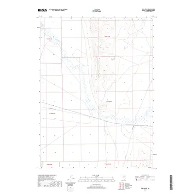
2018 Map of Sod House
USGS Topo · Published 2018About this map
The Quinn River meanders through the high desert of Humboldt County, defining the drainage patterns of this arid landscape. This 2018 survey captures the intersection of natural features and historic transit routes, most notably at the small settlement of Sod House. To the north, the Double H Mountains provide significant relief against the surrounding basin, while Sod House Point serves as a prominent landform overlooking the river's path. The presence of Cheuetto Spring and the Quinn River Lakes highlights the scarce but vital water sources in this region. This map is particularly useful for tracing the path of the Old Winnemucca-Denio Rd, a primary desert thoroughfare that meets Sod House Rd near the namesake settlement.
Find a feature on this map
14 named features on this map. Tap any name to fly to it.
Don’t see what you’re looking for? This feature index may not catch every label — zoom into the map to look around manually.
Map Details
Editions of this 2018 Sod House Map
This is the sole edition of this map. No revisions or reprints were ever made.
Other maps of this area

1882 · Paradise
USGS Topo · 1:250,000

1886 · Disaster
USGS Topo · 1:250,000

1893 · Paradise
USGS Topo · 1:250,000

1893 · Disaster
USGS Topo · 1:250,000

1954 · Vya
USGS Topo · 1:250,000

1955 · McDermitt
USGS Topo · 1:250,000

1958 · Vya
USGS Topo · 1:250,000

1958 · Awakening Peak
USGS Topo · 1:62,500

1959 · McDermitt
USGS Topo · 1:250,000

1959 · Orovada
USGS Topo · 1:62,500