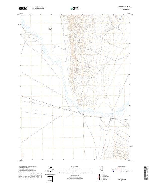
2021 Map of Sod House
USGS Topo · Published 2021About this map
Quinn River meanders through the heart of this Humboldt County basin, where the expansive Quinn River Valley meets the lower elevations of Desert Valley. The topography is dominated by the western slopes of the Double H Mountains, which rise sharply above the flatlands to the east. A prominent geographic marker, Sod House Point, overlooks the valley floor near the junction of several historic transport routes. The landscape's connectivity is defined by the Old Winnemucca-Denio Rd, a critical path for early 20th-century travel through northern Nevada. To the northwest, the Kings River Valley opens up, while isolated water sources like Cheuetto Spring provide rare hydrologic relief in this arid basin-and-range environment. The map details the Public Land Survey System (PLSS) grid, including t41n r35e, providing essential data for land use and property research.
Find a feature on this map
15 named features on this map. Tap any name to fly to it.
Don’t see what you’re looking for? This feature index may not catch every label — zoom into the map to look around manually.
Map Details
Editions of this 2021 Sod House Map
This is the sole edition of this map. No revisions or reprints were ever made.
Other maps of this area

1882 · Paradise
USGS Topo · 1:250,000

1886 · Disaster
USGS Topo · 1:250,000

1893 · Paradise
USGS Topo · 1:250,000

1893 · Disaster
USGS Topo · 1:250,000

1954 · Vya
USGS Topo · 1:250,000

1955 · McDermitt
USGS Topo · 1:250,000

1958 · Vya
USGS Topo · 1:250,000

1958 · Awakening Peak
USGS Topo · 1:62,500

1959 · McDermitt
USGS Topo · 1:250,000

1959 · Orovada
USGS Topo · 1:62,500