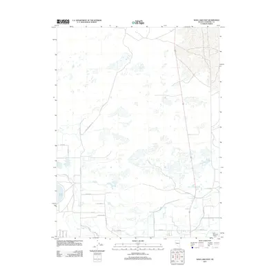
2011 Map of Soda Lake East
USGS Topo · Published 2011About this map
The California Emigrant Trl cuts a historical path across this Churchill County landscape, marking the enduring legacy of westward migration in Nevada. To the west, the basin is anchored by the waters of Soda Lake, while a network of modern roads and irrigation infrastructure, such as the T Line Canal Rd, demonstrates the 21st-century agricultural and residential adaptation of the high desert. The southern portion of the map shows a transition toward more concentrated development near the Fallon Municipal Airport. Residential clusters are named for family or thematic interests, with streets like Edwards Ln, Rancheria Dr, and Hillsboro Blvd branching off from the arterial Soda Lake Rd. This survey captures the intersection of historical transit corridors and contemporary desert living, where the Old River Rd and the Old Reservoir remain as markers of the area's hydrology.
Find a feature on this map
24 named features on this map. Tap any name to fly to it.
Don’t see what you’re looking for? This feature index may not catch every label — zoom into the map to look around manually.
Map Details
Editions of this 2011 Soda Lake East Map
This is the sole edition of this map. No revisions or reprints were ever made.
Other maps of this area

1908 · Carson Sink
USGS Topo · 1:250,000

1910 · Carson Sink
USGS Topo · 1:250,000

1950 · Stillwater
USGS Topo · 1:62,500

1951 · Carson Lake
USGS Topo · 1:62,500

1951 · Soda Lake
USGS Topo · 1:62,500

1951 · Fallon
USGS Topo · 1:62,500

1957 · Reno
USGS Topo · 1:250,000

1959 · Reno
USGS Topo · 1:250,000

1960 · Reno
USGS Topo · 1:250,000

1979 · Carson Sink
USGS Topo · 1:100,000