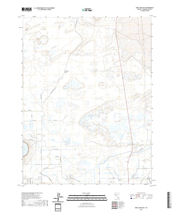
2021 Map of Soda Lake East
USGS Topo · Published 2021About this map
The Fortymile Desert landscape of Churchill County is defined here by the intersection of historic overland travel and modern agricultural water management. The route of the California Emigrant Trl cuts across the northern arid plains, marking a significant corridor of western migration through what was once one of the most difficult stretches of the journey to the coast. Contrastingly, the southern half of the sheet is dominated by a complex network of man-made waterways, including the T Line Canal and numerous irrigation channels like Wade Drain, R Drain, and Lower Soda Lake Drain. These features represent the extensive desert reclamation efforts that transformed this portion of Nevada. Near the western edge, Soda Lake sits as a prominent natural feature, while the southeastern corner is anchored by the Fallon Municipal Airport and a grid of rural roads such as Soda Lake Rd and Old River Rd.
Find a feature on this map
37 named features on this map. Tap any name to fly to it.
Don’t see what you’re looking for? This feature index may not catch every label — zoom into the map to look around manually.
Map Details
Editions of this 2021 Soda Lake East Map
This is the sole edition of this map. No revisions or reprints were ever made.
Other maps of this area

1908 · Carson Sink
USGS Topo · 1:250,000

1910 · Carson Sink
USGS Topo · 1:250,000

1950 · Stillwater
USGS Topo · 1:62,500

1951 · Carson Lake
USGS Topo · 1:62,500

1951 · Soda Lake
USGS Topo · 1:62,500

1951 · Fallon
USGS Topo · 1:62,500

1957 · Reno
USGS Topo · 1:250,000

1959 · Reno
USGS Topo · 1:250,000

1960 · Reno
USGS Topo · 1:250,000

1979 · Carson Sink
USGS Topo · 1:100,000