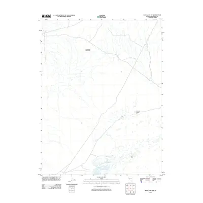
2011 Map of Soda Lake NW
USGS Topo · Published 2011About this map
Hot Springs Mountains dominate the northwestern sector of this arid landscape, giving way to the expansive Fortymile Desert in the east. This section of Nevada is defined by its sparse infrastructure and vast alluvial drainage patterns. A singular point of interest for industrial and local history is Falais Siding, a rail point located in the south-central portion of the map. This siding represents the intersection of the regional transportation network with the harsh desert floor, where ephemeral water flows and shifting terrain dictate the placement of roads and railway lines through the Churchill County interior.
Find a feature on this map
3 named features on this map. Tap any name to fly to it.
Don’t see what you’re looking for? This feature index may not catch every label — zoom into the map to look around manually.
Map Details
Editions of this 2011 Soda Lake NW Map
This is the sole edition of this map. No revisions or reprints were ever made.
Other maps of this area

1890 · Wadsworth
USGS Topo · 1:125,000

1892 · Wadsworth
USGS Topo · 1:125,000

1894 · Wadsworth
USGS Topo · 1:125,000

1908 · Carson Sink
USGS Topo · 1:250,000

1910 · Carson Sink
USGS Topo · 1:250,000

1951 · Soda Lake
USGS Topo · 1:62,500

1951 · Desert Peak
USGS Topo · 1:62,500

1957 · Fireball Ridge
USGS Topo · 1:62,500

1957 · Two Tips
USGS Topo · 1:62,500

1957 · Reno
USGS Topo · 1:250,000