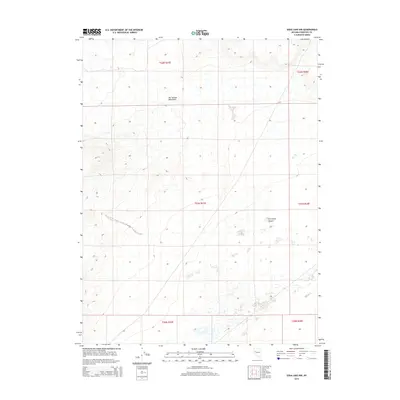
2014 Map of Soda Lake NW
USGS Topo · Published 2014About this map
The Hot Springs Mountains dominate the northwestern portion of this Churchill County landscape, characterized by high elevations and steep contour intervals. This desert terrain transitions into the expanse of the Fortymile Desert in the southeast, where the topography levels out into a region marked by numerous small depressions and scattered alkali flats. The grid system of the Public Land Survey System is clearly defined across several townships, including t21n r27e and t22n r28e, providing a precise framework for understanding land division in this arid part of Nevada. While the map is sparse of named settlements, the intricate contour lines and drainage patterns offer detailed insight into the geomorphology of the Great Basin during the early twenty-first century.
Find a feature on this map
8 named features on this map. Tap any name to fly to it.
Don’t see what you’re looking for? This feature index may not catch every label — zoom into the map to look around manually.
Map Details
Editions of this 2014 Soda Lake NW Map
This is the sole edition of this map. No revisions or reprints were ever made.
Other maps of this area

1890 · Wadsworth
USGS Topo · 1:125,000

1892 · Wadsworth
USGS Topo · 1:125,000

1894 · Wadsworth
USGS Topo · 1:125,000

1908 · Carson Sink
USGS Topo · 1:250,000

1910 · Carson Sink
USGS Topo · 1:250,000

1951 · Soda Lake
USGS Topo · 1:62,500

1951 · Desert Peak
USGS Topo · 1:62,500

1957 · Fireball Ridge
USGS Topo · 1:62,500

1957 · Two Tips
USGS Topo · 1:62,500

1957 · Reno
USGS Topo · 1:250,000