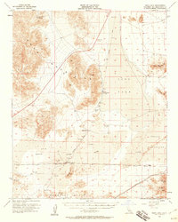
1956 Map of Soda Lake
USGS Topo · Published 1960About this map
The Mojave River terminates in the arid expanse of Soda Lake, a prominent feature of the Mojave Desert landscape in the mid-1950s. The region is defined by its transit history, particularly the Union Pacific rail line crossing the southern flats and an Old Railroad Grade cutting north through the Soda Mountains. Small outposts like Crucero, Balch, and the Rasor Ranch provide evidence of human activity in an otherwise austere environment dominated by the shifting sands of the Devils Playground.
Find a feature on this map
31 named features on this map. Tap any name to fly to it.
Don’t see what you’re looking for? This feature index may not catch every label — zoom into the map to look around manually.
Map Details
Editions of this 1956 Soda Lake Map
3 editions found
Other maps of this area

1910 · Ivanpah
USGS Topo · 1:250,000

1912 · Ivanpah
USGS Topo · 1:250,000

1933 · Avawatz Mountains
USGS Topo · 1:250,000

1942 · Ivanpah
USGS Topo · 1:250,000

1942 · Amboy
USGS Topo · 1:250,000

1943 · Amboy
USGS Topo · 1:250,000

1947 · Trona
USGS Topo · 1:250,000

1947 · Kingman
USGS Topo · 1:250,000

1948 · Kingman
USGS Topo · 1:250,000

1948 · Red Pass Lake
USGS Topo · 1:62,500