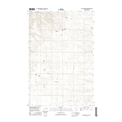
2017 Map of Soda Spring Coulee
USGS Topo · Published 2017About this map
Everson Bench and Alton Bench dominate this portion of the Fergus County landscape, where the high plains are deeply incised by a series of drainage systems known locally as coulees. These erosional features, including Soda Spring Coulee, Blood Coulee, and Mossey Coulee, dictate the orientation of rural transit and land use. The topography is defined by the sharp transition from these flat-topped benches to the winding bottoms of Big Coulee and Black Butte Coulee.
Find a feature on this map
22 named features on this map. Tap any name to fly to it.
Don’t see what you’re looking for? This feature index may not catch every label — zoom into the map to look around manually.
Map Details
Editions of this 2017 Soda Spring Coulee Map
This is the sole edition of this map. No revisions or reprints were ever made.
Other maps of this area

1954 · Lewistown
USGS Topo · 1:250,000

1959 · Lewistown
USGS Topo · 1:250,000

1964 · Wolf Creek Falls
USGS Topo · 1:24,000

1964 · Spring Coulee
USGS Topo · 1:24,000
1978 · Soda Spring Coulee
USGS Topo · 1:24,000

1978 · Wild Bill Flat West
USGS Topo · 1:24,000
1978 · Steele Lake Coulee
USGS Topo · 1:24,000

1978 · Toney Bench
USGS Topo · 1:24,000
1978 · Hoosac
USGS Topo · 1:24,000

1978 · Lewistown
USGS Topo · 1:100,000