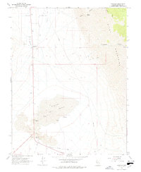
1967 Map of Sodaville
USGS Topo · Published 1978About this map
Sodaville and the expansive Rhodes Salt Marsh dominate this high-desert landscape in central Nevada. The map captures an era of transition where early transportation corridors left their mark on the arid terrain, most notably through the Old Railroad Grade and various Jeep Trails that skirt the edges of the Pilot Mountains. To the south, Tonopah Junction serves as a reminder of the region's historical connectivity, while the designated Rhodes (Site) marks the location of a former settlement near the salt flats. Natural water sources like Soda Springs, Martin Spring, and a Flowing Well appear as vital landmarks in the Soda Spring Valley, punctuating a topography of Sand Dunes and Alkali Flat. The map also documents industrial activity through various Gravel Pits and Tailings piles, reflecting the area's mineral-driven economy.
Find a feature on this map
26 named features on this map. Tap any name to fly to it.
Don’t see what you’re looking for? This feature index may not catch every label — zoom into the map to look around manually.
Map Details
Editions of this 1967 Sodaville Map
2 editions found
Other maps of this area

1907 · Tonopah
USGS Topo · 1:250,000

1908 · Tonopah
USGS Topo · 1:250,000

1909 · Hawthorne
USGS Topo · 1:250,000

1911 · Hawthorne
USGS Topo · 1:250,000

1915 · Hawthorne
USGS Topo · 1:250,000

1948 · Walker Lake
USGS Topo · 1:250,000

1956 · Tonopah
USGS Topo · 1:250,000

1957 · Walker Lake
USGS Topo · 1:250,000

1959 · Tonopah
USGS Topo · 1:250,000

1962 · Walker Lake
USGS Topo · 1:250,000