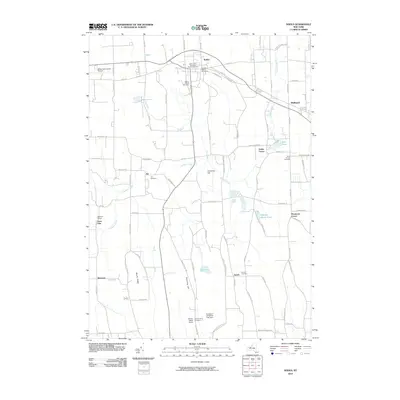
2010 Map of Sodus
USGS Topo · Published 2010About this map
Sodus and its surrounding hamlets are defined by a network of agricultural land and early cemeteries that tell the story of Wayne County settlement. The landscape is punctuated by numerous family and community burial grounds, including the Old Mill Street Cemetery and the Saint John's Episcopal Church Cemetery near the town center. To the south, smaller clusters like Joy and Zurich are connected by a grid of rural roads, while industrial remnants such as the Lime Kiln at Bushart Farms point to the area's geological utility. The drainage of Salmon Creek and its tributaries, including Fly Creek and First Creek, shapes the terrain around prominent rises like Governor Hill and Brantling Hill. Modern land use is visible in the presence of the Williamson-Sodus Airport and specialized agriculture at the Evergreen Christmas Tree Farm, reflecting the continued evolution of this productive corridor near the Lake Ontario shoreline.
Find a feature on this map
90 named features on this map. Tap any name to fly to it.
Don’t see what you’re looking for? This feature index may not catch every label — zoom into the map to look around manually.
Map Details
Editions of this 2010 Sodus Map
This is the sole edition of this map. No revisions or reprints were ever made.
Other maps of this area

1899 · Palmyra
USGS Topo · 1:62,500

1902 · Sodus Bay
USGS Topo · 1:62,500

1902 · Pultneyville
USGS Topo · 1:62,500

1902 · Clyde
USGS Topo · 1:62,500

1902 · Palmyra
USGS Topo · 1:62,500

1942 · Pultneyville
USGS Topo · 1:31,680

1943 · Lyons
USGS Topo · 1:31,680

1943 · Williamson
USGS Topo · 1:31,680

1943 · Sodus Point
USGS Topo · 1:31,680

1943 · Sodus
USGS Topo · 1:31,680