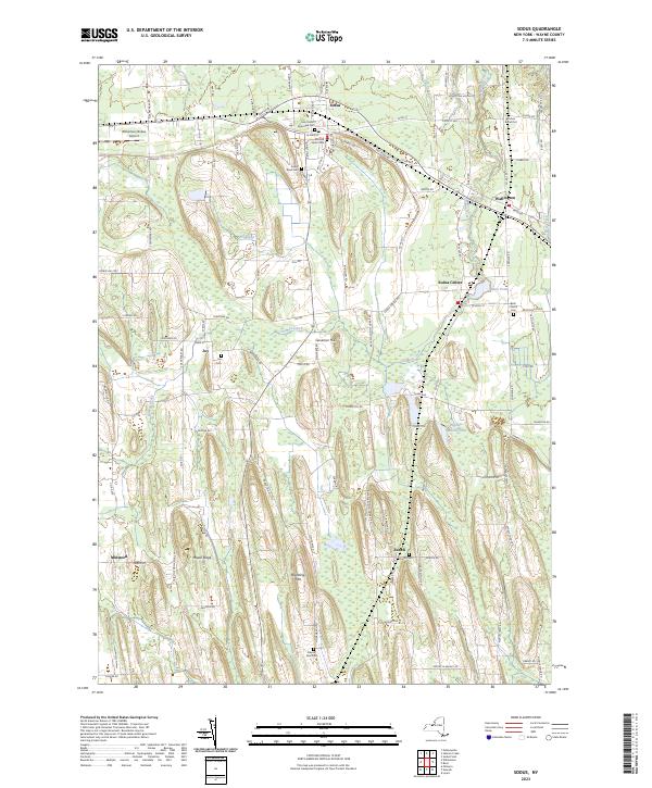
2023 Map of Sodus
USGS Topo · Published 2023About this map
Sodus and its surrounding hamlets in Wayne County are defined by a series of drumlins and the meandering course of Salmon Creek. The landscape preserves a significant collection of family and community history through its many small cemeteries, ranging from the Old Mill Street Cem and Sodus Rural Cem in town to the remote Kitchen Burial Plot and Glerum Farm Cem to the south. The settlement pattern is anchored by Sodus Center, Wallington, and Joy, connected by a network of traditional thoroughfares like Ridge Rd and Old Ridge Rd. Modern infrastructure is represented by the Williamson/Sodus Airport on the western edge of the quadrangle. High ground is marked by Governor Hill and Brantling Hill, while water features like Metz Pond and the Wildlife Marsh Pond suggest the low-lying wetlands that alternate with the agricultural drumlin fields.
Find a feature on this map
102 named features on this map. Tap any name to fly to it.
Don’t see what you’re looking for? This feature index may not catch every label — zoom into the map to look around manually.
Map Details
Editions of this 2023 Sodus Map
This is the sole edition of this map. No revisions or reprints were ever made.
Other maps of this area

1899 · Palmyra
USGS Topo · 1:62,500

1902 · Sodus Bay
USGS Topo · 1:62,500

1902 · Pultneyville
USGS Topo · 1:62,500

1902 · Clyde
USGS Topo · 1:62,500

1902 · Palmyra
USGS Topo · 1:62,500

1942 · Pultneyville
USGS Topo · 1:31,680

1943 · Lyons
USGS Topo · 1:31,680

1943 · Williamson
USGS Topo · 1:31,680

1943 · Sodus Point
USGS Topo · 1:31,680

1943 · Sodus
USGS Topo · 1:31,680