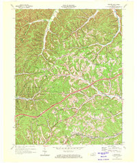
1970 Map of Soldier
USGS Topo · Published 1972About this map
Soldier and Haldeman anchor the southern corridor of this map, situated along the Chesapeake and Ohio railroad line in the early 1970s. The landscape is defined by the dense, branching drainage systems of Tygarts Creek and Grassy Fork, where numerous family-named hollows and branches, such as Dyer Branch and Butler Branch, provide a detailed record of the area's ancestral geography. Industrial activity is evident in the scattered Claypits found near the western borders, reflecting the region's historical reliance on mineral extraction.
Find a feature on this map
88 named features on this map. Tap any name to fly to it.
Don’t see what you’re looking for? This feature index may not catch every label — zoom into the map to look around manually.
Map Details
Editions of this 1970 Soldier Map
This is the sole edition of this map. No revisions or reprints were ever made.
Other maps of this area

1929 · Morehead
USGS Topo · 1:48,000

1935 · Morehead
USGS Topo · 1:62,500

1950 · Head Of Grassy
USGS Topo · 1:24,000

1950 · Wesleyville
USGS Topo · 1:24,000

1950 · Olive Hill
USGS Topo · 1:24,000

1950 · Ault
USGS Topo · 1:24,000

1951 · Soldier
USGS Topo · 1:24,000

1951 · Cranston
USGS Topo · 1:24,000

1951 · Stricklett
USGS Topo · 1:24,000

1953 · Haldeman
USGS Topo · 1:24,000