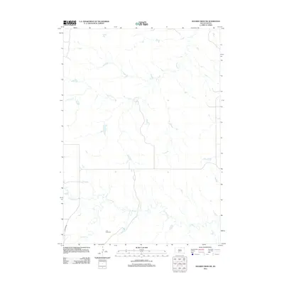
2012 Map of Soldier Creek NW
USGS Topo · Published 2012About this map
Holy Family Cem sits in the southern reach of this landscape, offering a specific point of interest for genealogical research in Mellette County. The terrain is defined by a dendritic network of seasonal and perennial waterways, most notably the winding course of Cut Meat Cr which meanders across the lower half of the quadrangle. In the north, S Br Pine Cr and its various tributaries carve through the prairie, while Gray Eagletail Cr drains the western portion of the sheet. Transportation is limited to a sparse grid of local routes and White River Rd, reflecting the remote and rural character of this South Dakota region. This 2012 survey provides a detailed digital representation of the area's hydrography and elevation before further modern development.
Find a feature on this map
5 named features on this map. Tap any name to fly to it.
Don’t see what you’re looking for? This feature index may not catch every label — zoom into the map to look around manually.
Map Details
Editions of this 2012 Soldier Creek NW Map
This is the sole edition of this map. No revisions or reprints were ever made.
Other maps of this area

1955 · Martin
USGS Topo · 1:250,000

1958 · Martin
USGS Topo · 1:250,000

1969 · Soldier Creek NE
USGS Topo · 1:24,000

1969 · Parmelee NE
USGS Topo · 1:24,000

1969 · Soldier Creek
USGS Topo · 1:24,000

1969 · Parmelee
USGS Topo · 1:24,000

1969 · Soldier Creek NW
USGS Topo · 1:24,000

1969 · Soldier Creek SE
USGS Topo · 1:24,000

1980 · Kadoka
USGS Topo · 1:100,000

1981 · Cedar Butte
USGS Topo · 1:25,000