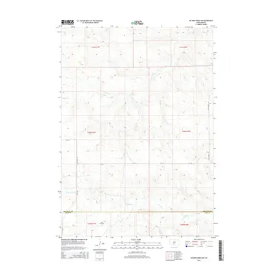
2015 Map of Soldier Creek NW
USGS Topo · Published 2015About this map
The rolling prairies of the Rosebud Indian Reservation area are defined by the convergence of several drainages, most notably S Br Pine Cr and Cut Meat Cr. This 2015 survey illuminates the transition between Mellette Co and Todd Co, where the landscape remains largely open and agricultural. A significant cultural landmark, the Holy Family Cem, sits near the southern boundary, offering a point of interest for those tracing local family lineages. The road network follows a strict sectional grid, with 275th St and 257th Ave providing primary access through the undulating terrain. Other water features like Gray Eagle Tail Cr further segment the geography, illustrating the natural watercourses that have historically influenced land use and settlement patterns in this part of South Dakota.
Find a feature on this map
10 named features on this map. Tap any name to fly to it.
Don’t see what you’re looking for? This feature index may not catch every label — zoom into the map to look around manually.
Map Details
Editions of this 2015 Soldier Creek NW Map
This is the sole edition of this map. No revisions or reprints were ever made.
Other maps of this area

1955 · Martin
USGS Topo · 1:250,000

1958 · Martin
USGS Topo · 1:250,000

1969 · Soldier Creek NE
USGS Topo · 1:24,000

1969 · Parmelee NE
USGS Topo · 1:24,000

1969 · Soldier Creek
USGS Topo · 1:24,000

1969 · Parmelee
USGS Topo · 1:24,000

1969 · Soldier Creek NW
USGS Topo · 1:24,000

1969 · Soldier Creek SE
USGS Topo · 1:24,000

1980 · Kadoka
USGS Topo · 1:100,000

1981 · Cedar Butte
USGS Topo · 1:25,000