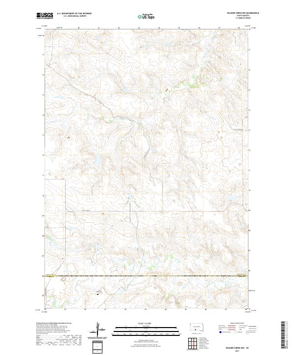
2021 Map of Soldier Creek NW
USGS Topo · Published 2021About this map
Holy Family Cem serves as a central landmark in this portion of South Dakota, located near the southern border between Mellette County and Todd County. The landscape is defined by the winding drainages of Cut Meat Cr, S Br Pine Cr, and Gray Eaglefoot Cr, which carve through the terrain and influence the local road network. These routes, including White River Rd, Ring Thunder Rd, and the uniquely named Surprise Valley Rd, follow the natural contours of the land rather than a strict grid, reflecting the adaptation of transit to the region's undulating topography. This survey captures a rural landscape where seasonal waterways and township boundaries dictate the spatial organization of the countryside.
Find a feature on this map
14 named features on this map. Tap any name to fly to it.
Don’t see what you’re looking for? This feature index may not catch every label — zoom into the map to look around manually.
Map Details
Editions of this 2021 Soldier Creek NW Map
This is the sole edition of this map. No revisions or reprints were ever made.
Other maps of this area

1955 · Martin
USGS Topo · 1:250,000

1958 · Martin
USGS Topo · 1:250,000

1969 · Soldier Creek NE
USGS Topo · 1:24,000

1969 · Parmelee NE
USGS Topo · 1:24,000

1969 · Soldier Creek
USGS Topo · 1:24,000

1969 · Parmelee
USGS Topo · 1:24,000

1969 · Soldier Creek NW
USGS Topo · 1:24,000

1969 · Soldier Creek SE
USGS Topo · 1:24,000

1980 · Kadoka
USGS Topo · 1:100,000

1981 · Cedar Butte
USGS Topo · 1:25,000