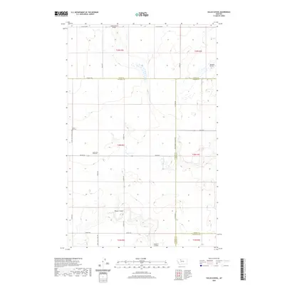
2020 Map of Sollid School
USGS Topo · Published 2020About this map
Dead Indian Coulee and Pondera Coulee define the drainage patterns of this rural landscape, where four Montana counties—Toole, Pondera, Liberty, and Chouteau—converge. The area is marked by the legacy of early 20th-century education and community life, anchored by the Sollid School (historical) and the Golden West Cem located along Golden West Cemetery Rd. A sparse network of family-named roads like Boyum Rd, Torske Rd, and Iversen Rd connects the isolated ranching operations, such as Denson Ranch, to the wider region. The map highlights the intersection of public infrastructure and private land use, including the proximity of St Olaf Church to the northern boundary. The terrain is characterized by winding seasonal coulees and features like Shotgun Slough, illustrating the importance of water management in this northern plains environment.
Find a feature on this map
33 named features on this map. Tap any name to fly to it.
Don’t see what you’re looking for? This feature index may not catch every label — zoom into the map to look around manually.
Map Details
Editions of this 2020 Sollid School Map
This is the sole edition of this map. No revisions or reprints were ever made.
Other maps of this area

1920 · Conrad
USGS Topo · 1:125,000

1954 · Shelby
USGS Topo · 1:250,000

1958 · Shelby
USGS Topo · 1:250,000

1967 · Central School
USGS Topo · 1:24,000
1967 · Fowler Coulee SE
USGS Topo · 1:24,000
1967 · Fowler Coulee NE
USGS Topo · 1:24,000

1970 · Knees NE
USGS Topo · 1:24,000

1970 · Knees
USGS Topo · 1:24,000

1970 · Sollid School
USGS Topo · 1:24,000

1970 · Pondera School
USGS Topo · 1:24,000