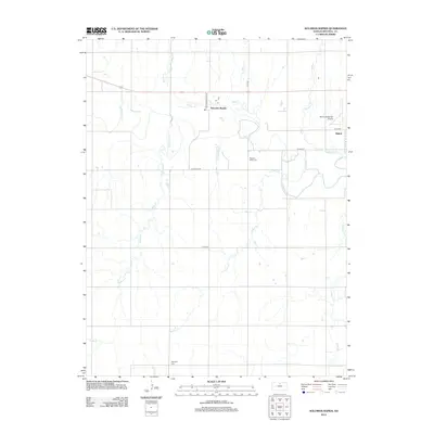
2012 Map of Solomon Rapids
USGS Topo · Published 2012About this map
Solomon River meanders through this agricultural landscape of Mitchell County, where the small community of Solomon Rapids and the western edge of Beloit sit along the northern reaches of the valley. The terrain is defined by a dense network of tributaries, including Indian Cr, Turkey Cr, and Browns Cr, which carve a detailed drainage pattern across the plains. This 2012 survey illustrates the enduring rural infrastructure of the region, anchored by established landmarks such as the Moritz Memorial Airport and several historic burial grounds. Local genealogists will find the locations of Pleasant Valley Cem and Hopewell Cem particularly useful for tracing family roots. The road network, featuring Tipton Rd and W Main St Rd, connects these scattered homesteads and watercourses, reflecting a settlement pattern built around the fertile river bottoms and upland grazing areas.
Find a feature on this map
18 named features on this map. Tap any name to fly to it.
Don’t see what you’re looking for? This feature index may not catch every label — zoom into the map to look around manually.
Map Details
Editions of this 2012 Solomon Rapids Map
This is the sole edition of this map. No revisions or reprints were ever made.
Other maps of this area

1894 · Mankato
USGS Topo · 1:125,000

1894 · Beloit
USGS Topo · 1:125,000

1953 · Solomon Rapids
USGS Topo · 1:24,000

1953 · Glen Elder South
USGS Topo · 1:24,000

1953 · Beloit
USGS Topo · 1:24,000

1955 · Beloit
USGS Topo · 1:250,000

1959 · Beloit
USGS Topo · 1:250,000

1962 · Jewell SE
USGS Topo · 1:24,000

1962 · Glen Elder North
USGS Topo · 1:24,000

1962 · Jewell SW
USGS Topo · 1:24,000