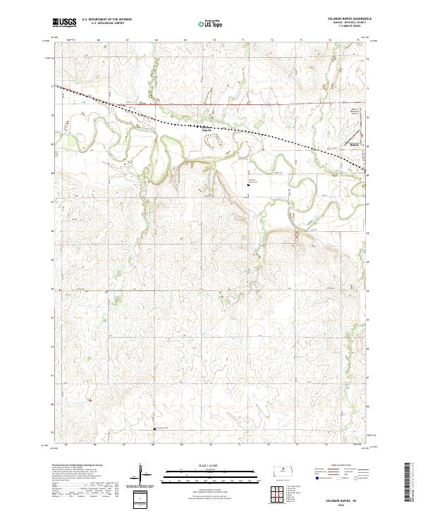
2022 Map of Solomon Rapids
USGS Topo · Published 2022About this map
The Solomon River meanders across this northern Kansas landscape, carving a fertile valley through Mitchell County. The map captures the small community of Solomon Rapids and the western edge of Beloit, where the section-line grid of the American West is clearly defined by local routes like Tipton Rd and W Main St Rd. This agricultural region is shaped by a dense network of tributaries including Browns Cr, Indian Cr, and Turkey Cr, which drain the surrounding highlands toward the main river channel.
Find a feature on this map
32 named features on this map. Tap any name to fly to it.
Don’t see what you’re looking for? This feature index may not catch every label — zoom into the map to look around manually.
Map Details
Editions of this 2022 Solomon Rapids Map
This is the sole edition of this map. No revisions or reprints were ever made.
Other maps of this area

1894 · Mankato
USGS Topo · 1:125,000

1894 · Beloit
USGS Topo · 1:125,000

1953 · Solomon Rapids
USGS Topo · 1:24,000

1953 · Glen Elder South
USGS Topo · 1:24,000

1953 · Beloit
USGS Topo · 1:24,000

1955 · Beloit
USGS Topo · 1:250,000

1959 · Beloit
USGS Topo · 1:250,000

1962 · Jewell SE
USGS Topo · 1:24,000

1962 · Glen Elder North
USGS Topo · 1:24,000

1962 · Jewell SW
USGS Topo · 1:24,000