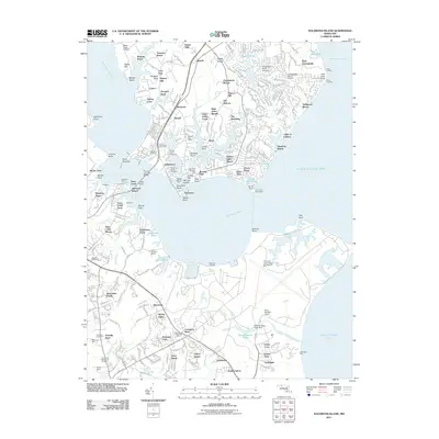
2011 Map of Solomons Island
USGS Topo · Published 2011About this map
Solomons and the surrounding Chesapeake shoreline at the start of the 2010s reveal a landscape defined by maritime heritage and modern military presence. The southern tip of Calvert County is anchored by the historic Drum Point Lighthouse and the strategic narrows of the Patuxent River, spanned here by the Thomas Johnson Bridge. Inland, the map documents established communities like Dowell, Johnstown, and Olivet, alongside specialized infrastructure such as the Chesapeake Ranch Airport and the expansive Patuxent River Naval Air Station. Small coves and creeks including Hellen Creek, Mill Creek, and Saint Johns Creek carve into the peninsula, illustrating the dense interface between land and water. Researchers can locate several burial grounds including Solomons Island Cemetery and Ebenezer Cemetery, providing valuable data for local genealogy. The map also highlights significant terrain features like the Cliffs of Calvert and the varied points along the shore, from Point Patience to Hog Point.
Find a feature on this map
110 named features on this map. Tap any name to fly to it.
Don’t see what you’re looking for? This feature index may not catch every label — zoom into the map to look around manually.
Map Details
Editions of this 2011 Solomons Island Map
This is the sole edition of this map. No revisions or reprints were ever made.
Other maps of this area

1892 · Leonardtown
USGS Topo · 1:62,500

1892 · Drum Point
USGS Topo · 1:62,500

1892 · Piney Point
USGS Topo · 1:62,500

1894 · Piney Point
USGS Topo · 1:62,500

1894 · Point Lookout
USGS Topo · 1:62,500

1895 · Leonardtown
USGS Topo · 1:62,500

1895 · Nomini
USGS Topo · 1:125,000

1895 · Piney Point
USGS Topo · 1:62,500

1898 · Nomini
USGS Topo · 1:125,000

1898 · St. Marys
USGS Topo · 1:125,000